By Ruby Pap

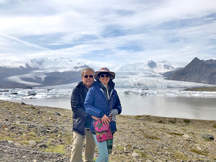
From left to right, Ruby Pap, Steve Taylor and Matt Diendorf are seen here doing a beach survey on Kaua‘i’s Westside, with the island of Ni‘iha in the background.
If you’ve lived here for any length of time, this question has probably crossed your mind from time to time.
Old timers may have observed the beaches come and go completely several times throughout their lifetime. If you were concerned lately because your favorite beach doesn’t seem to be recovering like it used to, your instinct may be correct.
The USGS National Assessment of Shoreline Change on the Hawaiian Islands has found that 71 percent of Kaua‘i’s beaches are eroding.
What is causing this?
One group of students from Kaua‘i Community College, with assistance from geologists and oceanographers, have been using beach profiling techniques to help answer this question on Kaua‘i’s Westside. Despite a published long-term average erosion rate of 1.5 feet/year, Kekaha Beach Park has seen dramatic episodic erosion in recent years, so much that Kekaha Beach in front of the revetment has disappeared completely.
Since summer 2012, the research team has collected valuable seasonal beach erosion data that is helping to explain these beach dynamics. This type of short-term data helps to augment the long-term data, which is an average rate calculated over the last 100 years.
The team consists of Dr. Stephen Taylor (Oceanographer, Kaua‘i Community College), Dr. Chuck Blay (Geologist, TEOK Investigations), Jana Rothenberg (Videographer, Janaj Productions), Dennis Rowley and Matt Diendorf (Pacific Missile Range Facility) and various KCC Marine Options Program Students. I joined the group in late 2012.
Using surveying equipment, we take monthly beach width and elevation data at set locations at six beaches in Kekaha and the Pacific Missile Range Facility, including in front of St. Theresa’s Church, MacArthur Park, Mana Drag Strip, Kokole Point, Majors Bay and Kinikini Ditch.
Blay and Taylor have been important mentors in guiding the students in the data collection effort. Blay spends time each month correlating the results to wave height and winter storm data.
Results show that sand accumulates at Major’s Bay and sand disappears at MacArthur Park during the summer months when north winter swells weaken and southern swells strengthen. In one season, the beach in front of MacArthur Park diminished by 215 feet! In the winter months, the beach moves back to MacArthur Park with high, north swells.
Take a look at The Story of Sand along the Mānā Plain: http://youtu.be/Gy8Jn6De7lU for an informative documentary video of the effort by Jana Rothenberg.

Ruby Pap
This may confirm what some know intuitively from living, working and playing on Kaua‘i their whole lives. But many are worried that Kekaha beach may never return to its former glory. To be sure, the revetment probably has something do with it.
Studies show that whenever you harden a shoreline with a seawall, beaches erode. But there may be other factors at play here, such as sea level rise and weather/storm cycles that occur over decades. This is where Blay comes in with his research, so stay tuned for more information!
- Ruby Pap is a Coastal Land Use Extension Agent at University of Hawai‘i Sea Grant College Program. She can be reached at rpap@hawaii.edu.
Discover more from ForKauaiOnline
Subscribe to get the latest posts sent to your email.


Leave a Reply