By Katie Twaddle
Photo by Na Pali Riders Raft Tours
While we think of Kauai as a paradise, its geology does not emulate a carefree or simple existence. Kauai’s past is complex, exciting, dangerous, and as unstable as its future.
Since the discovery of Kauai in 1778 by Captain Cook, the island’s lush valleys, high cliffs and soft, sandy beaches have been the distinguishing characteristics that draw so many to the Garden Island. But below the surface there is much more to Kauai’s magnificent beauty and terrain. There is a great past hiding within waterfalls, lava dikes and valleys.
About 5 million years ago there was a volcanic eruption along the Hawaii-Emperor Volcanic chain. The eruption sparked the beginning of the Hawaiian Islands and ultimately formed Kauai island, the oldest island in the main Hawaiian island chain. Continuous volcanic activity, formed each Hawaiian island, beginning as an underwater mountain that eventually rose above the surface of the ocean. Kauai went through three stages of development: 1) shield; 2) post-shield; and 3) rejuvenation. The shield stage refers to the first exposure of igneous and metamorphic rock, which became the foundation for the landmass. In the post-shield stage the volcanic eruptions slowed down. The lava dried and the excess magma invaded the previously formed rock, creating lava dikes and tubes on the cliffs. Finally, in the rejuvenation phase streams and rivers formed into valleys within the huge mountain that was early Kauai.
 While the volcanic activity that formed Kauai seems a mystical, basic creation, there were inherent problems with Kauai’s structure.
The countless volcanic eruptions ended up creating an initial island size of 1,155 square miles. Its highest peaks stood at nearly 8,500 ft. But because Kauai developed so rapidly, the actual structure of the island was weak.
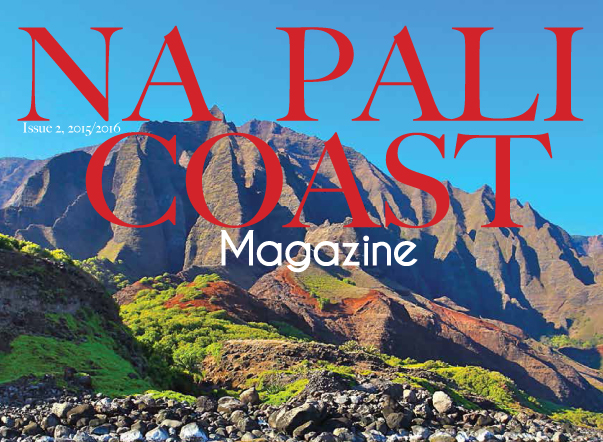
‘The resulting instability of such rapid growth … led to major structural failures such as the probably normal fault that formed the west escarpment of Waimea Canyon, … and Over time, Kauai lost nearly 3,000 ft. in elevation. Today, the highest peak on Kauai is Mt. Wai’ale’ale at 5,147 ft. The island now encompasses only 555 square miles. It is believed the eastern side of the island collapsed during the post-shield stage which caused the creation of Waimea Canyon. The western slope and the Na’Pali Coast remained upright, although extreme wave erosion has cut back on the Na’Pali Coast, creating its dramatic cliffs and accentuating lava tubes and dikes. Weathering and erosion is ever present on Kauai, and is exemplified best along the Na Pali Coast. The Na Pali, which translates to “the cliffs,” was first formed entirely of lava flows. Later, water flow on the island had a major affect on its shape. Mt. Wai’ale’ale is the wettest place on earth, receiving 448 inches of rain per year (Blay and Siemers, 2013). While today the water flow has changed due to irrigation measures taken by early settlers, 5 million years ago a massive amount of water was spilling onto the northwest side of the island, carving out the valleys of the Na Pali Coast. Not only were streams cutting down from within, giant waves up to 40-ft. high continuously battered the Na Pali Coast, and still do today. The sea caves along the Na’Pali were formed when the waves cut through the rock. And when the waves cut through faster than streams could carve, cliffs and waterfalls formed. The Na’Pali Coast stretches 17 miles from Ke’e Beach on the north shore to Polihale State Beach Park on the west shore, with cliffs reaching heights up to 4,000 ft. From end to end, and top to bottom, three different climates can be seen along the rugged Na Pali coastline. The best way to see the transformation between climates is by taking a Na Pali Coast boat tour. Beginning on the west and heading north along the coast, the landscape changes dramatically, starting as a desert and ending in a tropical rainforest. On the west side of the island there are cactuses growing and the landscape is mostly brown. On average, the west side receives 21 inches of rain per year. But as you head north, you will notice the vegetation turning greener. Looking up, at the very top of the cliffs, in Koke’e State Park, a temperate rain forest thrives. It is also a cooler atmosphere in the State Park, with temperatures staying within approx. 40-75 degrees Fahrenheit. The valleys become lush with rivers and cascading waterfalls. Eucalyptus trees and bamboo grow. These diverse ecosystems are what make Kauai a unique place to visit. Like the sandy beaches created by an unseen surrounding coral reef, there is more to this island than meets the eye. Kauai’s geologic history is not a simple one. In fact, Kauai is still extremely complex. It has now entered a dominantly destructive phase. The island is essentially disappearing. 71% of beaches on Kauai are eroding. Ocean waves and animals like wild pigs and goats are also causing massive amounts of erosion on the island. Also, Kauai rides along the Pacific Tectonic Plate, drifting north. Because of this, the island is slowly sinking. It is believed that Kauai will disappear within the next 20 to 25 million years. Just like everything on earth, there is a beginning and an end. We are between the two and lucky enough, we are granted the opportunity to explore and discover Kauai for all that it was and for all that it is. For more information about Kauai, please visit Na Pali Coast Magazine References: Blay, Chuck. Siemers, Robert. Kauai’s Geologic History A simplified Overview. TEOK Investigations, 2013. Print. Richmond, Bruce. “70 Percent of Beaches Eroding on Hawaiian Islands Kauai, Oahu, Maui.” Usgs.gov. usa.gov. 7 May 2012. 7 May 2012. http://www.usgs.gov/newsroom/article.asp?ID=3199 Subscribe to get the latest posts sent to your email.
Discover more from ForKauaiOnline


Leave a Reply